@mappingsupport@m.ai6yr.org
@mappingsupport@m.ai6yr.org avatar

mappingsupport

@mappingsupport@m.ai6yr.org

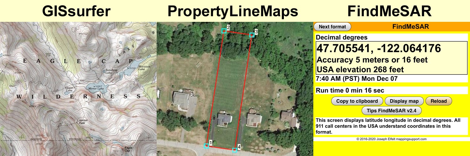
Developer of #GISsurfer web map using the #Leaflet map API.

Developer of #GeoJPG web app. Offline maps with NO ads, NO tracking, NO signup and NO fees. #PWA

Developer of #FindMeSAR web app. #PWA

Curator of 3,000+ #ArcGIS server list.

Consultant producing property line maps to help you find lost survey stakes.

Lives in #PNW.

This profile is from a federated server and may be incomplete. Browse more on the original instance.

ai6yr, to windows
@ai6yr@m.ai6yr.org avatar

The Verge: Windows AI feature that screenshots everything labeled a security ‘disaster’ https://www.theverge.com/2024/6/3/24170305/microsoft-windows-recall-ai-screenshots-security-privacy-issues #windows #ai #cybersecurity

mappingsupport,
@mappingsupport@m.ai6yr.org avatar

@ai6yr Grateful that my windows 10 PC is not able to be upgraded to windows 11. Apparently it lacks some motherboard feature that windows 11 requires.

mappingsupport, to random
@mappingsupport@m.ai6yr.org avatar

near Tracy California.
Map shows MODIS and VIIRS satellite heat detections. Data is not real time and locations are only approximate. For more info open the map and see 2 links upper left corner.

Never rely on any map or anything you see online to ignore an order to evacuate. The fire officials have information that you do not.

Open GISsurfer map
https://mappingsupport.com/p2/gissurfer.php?center=37.631503,-121.467247&zoom=12&basemap=USA_basemap&overlay=VIIRS_7_day,MODIS_7_day,State_boundary,Fire_perimeter&data=https://mappingsupport.com/p2/special_maps/disaster/USA_wildland_fire.txt

mappingsupport, to Bloomscrolling
@mappingsupport@m.ai6yr.org avatar

We have a viola refuge in our garden. It is next to the south side of our woodshed. The ground is covered with rocks we picked out of the garden and tossed over here. This spot gets zero care from us and is hot with sun radiating off the woodshed wall. The viola have self-seeded and are claiming this spot for their own.

ai6yr, to random
@ai6yr@m.ai6yr.org avatar

Ha! Figured out how to plot topos of wildfires. https://m.ai6yr.org/

mappingsupport,
@mappingsupport@m.ai6yr.org avatar

@ai6yr Are you grabbing the fire perimeter data from
https://services3.arcgis.com/T4QMspbfLg3qTGWY/arcgis/rest/services/WFIGS_Interagency_Perimeters_YearToDate/FeatureServer/0

Sometimes the NIFC FTP server has more recent perimeter data (KMZ file) based on an overnight infrared flight.

mappingsupport, to random
@mappingsupport@m.ai6yr.org avatar
mappingsupport, to random
@mappingsupport@m.ai6yr.org avatar

Interactive map for NW of Alto New Mexico. Latest perimeter data says 3,400+ acres burned. The MODIS and VIIRS satellite hotspot data will update later today - look for dark red symbols.

There is both a and for this area today. 😟

See 2 links upper left corner of the map for more info.

Open GISsurfer map:
https://mappingsupport.com/p2/gissurfer.php?center=33.437514,-105.761604&zoom=13&basemap=Open_Topo_Map&overlay=VIIRS_7_day,MODIS_7_day,State_boundary,Fire_perimeter&data=https://mappingsupport.com/p2/special_maps/disaster/USA_wildland_fire.txt

image/jpeg

mappingsupport, to random
@mappingsupport@m.ai6yr.org avatar
ai6yr, to inlandempire
@ai6yr@m.ai6yr.org avatar
mappingsupport,
@mappingsupport@m.ai6yr.org avatar

@ai6yr Needs a map. I took a quick look at the 2 Riverside county ArcGIS servers I know about but did not see an obvious layer with this data. So I pinged the county to see if they have GIS data showing the areas to be closed to hiking.

mappingsupport, to pnw
@mappingsupport@m.ai6yr.org avatar

His and her strawberries. First ones this year. There will be many more.
🍓

mappingsupport,
@mappingsupport@m.ai6yr.org avatar

@ai6yr I ate just half of one of those and was full. Saving the other half for lunch. 🤡

mappingsupport, to pnw
@mappingsupport@m.ai6yr.org avatar

Too funny. Can’t make this up.

Currently if King County WA needs to produce an evacuation map they only do so as a PDF. County emergency management (EM) staff says it would be very expensive to have county GIS staff produce an interactive evacuation map.

I volunteered to write data conversion code (geojson > kmz) so King County WA could use Google maps as an interactive evacuation map.

EM staff says policy prohibits them from using outside help that is not officially approved. So I contacted county procurement asking how I can get approved as a volunteer consultant. See pic for their reply.
🙄 🤦‍♂️

mappingsupport, to pnw
@mappingsupport@m.ai6yr.org avatar

Local foodbank will get some of our primo organic lettuce today.
#PNW #Gardens #Gardening #GrowYourOwn

mappingsupport,
@mappingsupport@m.ai6yr.org avatar

Went to the foodbank and made my pile of just-picked lettuce on one of the tables. I had quite a bit. Volunteer says "Did you grow all this"? 😲
Me: Well - I didn't steal it from the neighbors." 😁

mappingsupport,
@mappingsupport@m.ai6yr.org avatar

@ai6yr Whadaya mean 'gas'. You been bragging up your biking skill.

mappingsupport,
@mappingsupport@m.ai6yr.org avatar

@ai6yr Our foodbank is fairly local in downtown Redmond WA. I stopped on the other side of town for groceries.

mappingsupport, to random
@mappingsupport@m.ai6yr.org avatar

NE of Phoenix metro area continues to expand.

The text pic is from the “NOAA fire weather forecast”.

The map has lots of GIS overlays you can turn on/off/restack. For help please read the “Map tips” link in upper left corner.

Open GISsurfer map:
https://mappingsupport.com/p2/gissurfer.php?center=33.855451,-111.762886&zoom=12&basemap=Open_Topo_Map&overlay=VIIRS_7_day,MODIS_7_day,State_boundary,Fire_perimeter&data=https://mappingsupport.com/p2/special_maps/disaster/USA_wildland_fire.txt

image/jpeg

GottaLaff, to Canada
@GottaLaff@mastodon.social avatar

Ugh, totally wasted open house. Lookee-loo City. I'm so glad this was our last one before we leave. The rest will be after, and the house will be vacant.

Sigh.

So, with that, I'll perk myself up (and hopefully you) with another dopey gif.

I can't believe it'll be a week from tomorrow!

Have a good evening, everyone!
🇨🇦

video/mp4

mappingsupport,
@mappingsupport@m.ai6yr.org avatar

@GottaLaff Once upon a time many years ago our house in Wyoming did not sell. We packed up and moved back to the PNW leaving an empty house behind. Eventually the house sold and yours will also.

mappingsupport, to pnw
@mappingsupport@m.ai6yr.org avatar

1/_ 🧵 Many counties (including mine - King County WA) use the CodeRed system for alerting people about a wildfire evacuation. Recently I traded email with county staff and got some details about how this works.

If your county’s emergency management web page shows they use CodeRed then there should be a signup link. When you signup, enter your address or use the map by dragging the marker, zooming in and repeating until the marker is where you live.

If my area is ordered to evacuate then I want to get that message by every means possible. We have a landline so I entered our “Home phone” number, my cell number and my main email address that I check the most often.
#PNW #Wildfire

mappingsupport, to pnw
@mappingsupport@m.ai6yr.org avatar

Usually soggy King County WA (county seat - Seattle) is hiring for a Community Wildfire Protection Planner. Good! Nice to see local officials taking wildfire risk seriously.
#PNW #Wildfire

https://www.governmentjobs.com/careers/kingcounty/jobs/4501231/community-wildfire-protection-planner?page=3&pagetype=jobOpportunitiesJobs

mappingsupport, to Florida
@mappingsupport@m.ai6yr.org avatar

Interactive map shows parcels that will be flooded (blue shading) using sea level as of 2016 plus a two foot rise in sea level. Click any parcel for attribute data. H/T @ai6yr for the map idea.

Map covers all of Florida. It is centered on Miami Beach when it opens.

To search on an address, click Menu > Search.

Open GISsurfer map: https://bit.ly/3ymepk7

mappingsupport,
@mappingsupport@m.ai6yr.org avatar

@ai6yr might be kind of tough to get flood insurance there

mappingsupport, to random
@mappingsupport@m.ai6yr.org avatar

Here is the latest look at the near Fort Nelson British Columbia. That town has been ordered to evacuate. The red outline is the perimeter as of early today but there is now a lot of additional satellite heat detections outside of that perimeter.

Click “Map tips” upper left corner for more info.

Open GISsurfer map:
https://mappingsupport.com/p2/gissurfer.php?center=58.821030,-122.790070&zoom=11&basemap=Canada_Toporama&overlay=VIIRS_7_day,MODIS_7_day,CA_fire_perimeter,CA_active_fires,BC_fire_perimeter&txtfile=https://mappingsupport.com/p2/special_maps/disaster/Canada_wildland_fire.txt

mappingsupport, to random
@mappingsupport@m.ai6yr.org avatar

in east Texas.
Red = moderate
Purple = major

For near real time water level data, open the map, click any colored dot and follow the link. The graph might take a few seconds to load.

Open GISsurfer map:
https://mappingsupport.com/p2/gissurfer.php?center=30.218847,-95.064697&zoom=8&basemap=USA_basemap&overlay=State_boundary,Flood_major_or_moderate&data=https://mappingsupport.com/p2/special_maps/disaster/USA_weather.txt

image/jpeg

ai6yr, to random
@ai6yr@m.ai6yr.org avatar

This would be a great deal for someone with need to build a garden bed, but the timeframes this person have in their post ("must be gone tomorrow", ie today) are RIDICULOUS (unless you live next door). Have you ever moved that much weight before?

mappingsupport,
@mappingsupport@m.ai6yr.org avatar

@ai6yr

  1. Lift several blocks onto taligate
  2. Climb into truck bed
  3. Lift and place the blocks forward in the bed
  4. Climb out of truck bed
  5. Rinse and repeat
mappingsupport, to pnw
@mappingsupport@m.ai6yr.org avatar

Got garden weather?
39 and rain near Redmond WA this morning.

Mini greenhouse has several kinds of onions grown from seed and ready to transplant, some carrots, lettuce, and two bell pepper plants. Spinach and radishes have already been harvested and those areas will be replanted with carrots, radish and onions. I am curious if I can get Walla Walla onions to mature planting as late as May 1.

The pic with the raised bed has Davidor Shallots on the left and Walla Walla onions on the right. The Wallas were planted last fall and overwintered in the greenhouse. In the background are strawberries, garlic and early potatoes.
#PNW #Gardens #Gardening #GrowYourOwn

image/jpeg
image/jpeg
image/jpeg

mappingsupport,
@mappingsupport@m.ai6yr.org avatar

@ai6yr Newest seedlings on the left are on a heat mat. The ones on the right are just raised up to be closer to the light.

  • All
  • Subscribed
  • Moderated
  • Favorites
  • megavids
  • mdbf
  • magazineikmin
  • tacticalgear
  • InstantRegret
  • ethstaker
  • rosin
  • love
  • Youngstown
  • slotface
  • ngwrru68w68
  • kavyap
  • GTA5RPClips
  • DreamBathrooms
  • provamag3
  • everett
  • thenastyranch
  • cisconetworking
  • normalnudes
  • Durango
  • khanakhh
  • cubers
  • osvaldo12
  • tester
  • Leos
  • anitta
  • modclub
  • JUstTest
  • All magazines